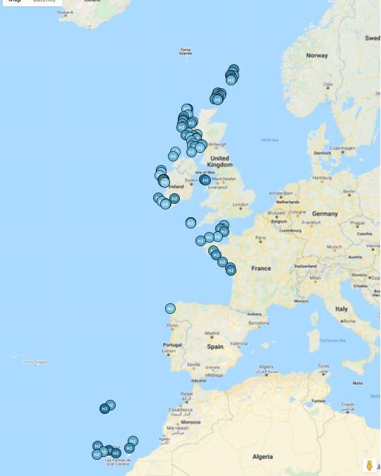
The Hydrogen Islands Readiness map is a tool developed within the SEAFUEL project, co-financed by the INTERREG Atlantic Area Programme 2014-2020.
The map investigates each island of the Atlantic Area in regards to a number of factors which include: energy resource, level of electricity production constraint, degree of environmental amenity for each island, existing transport distribution network, availability of water, degree to which there is existing renewable generation, population, presence or absence of large energy users on or adjacent to the island, regional policy context, national policy context and level of current public acceptance.
This tool was devised on foot of the research included in the project into hydrogen rollout on the islands participating in the project: Tenerife (Spain), Madeira (Portugal) and Árainn (Ireland) and is intended to be a starting point which surveys the current H2 context.
The map is meant to be updateable as the more mutable variables change over time. If you would like to participate directly in the data gathering to correct, or update any of these variables for a specific island (and this it’s degree of readiness as shown on the map) please contact Lúgh ó Braonáin of Energy Co-operatives Ireland Ltd on behalf of Comharchumann Fuinnimh Oileáin Árainn Teo at: info@energyco-ops.ie. Please state ‘H2 Readiness Map’ in your email title header.


Recent Comments